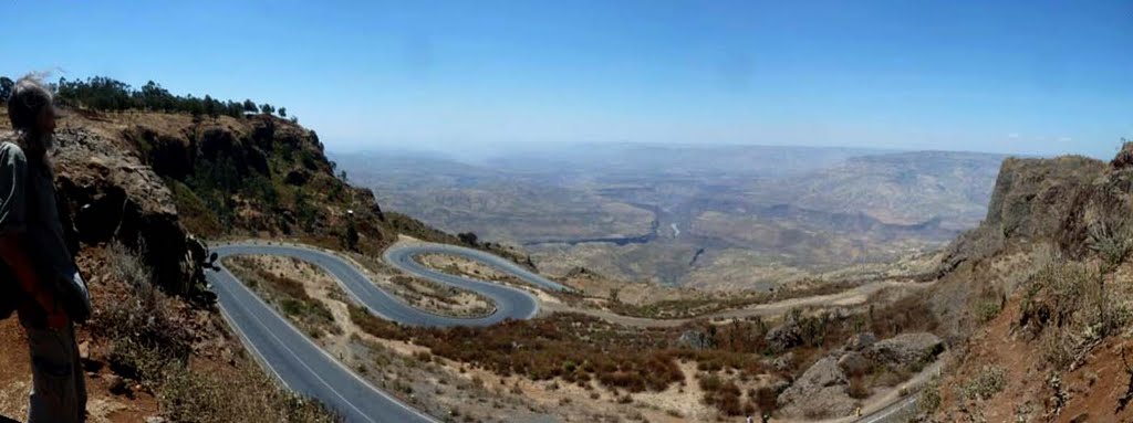
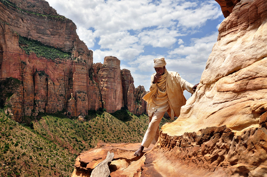
Abijata-Shalla National Park

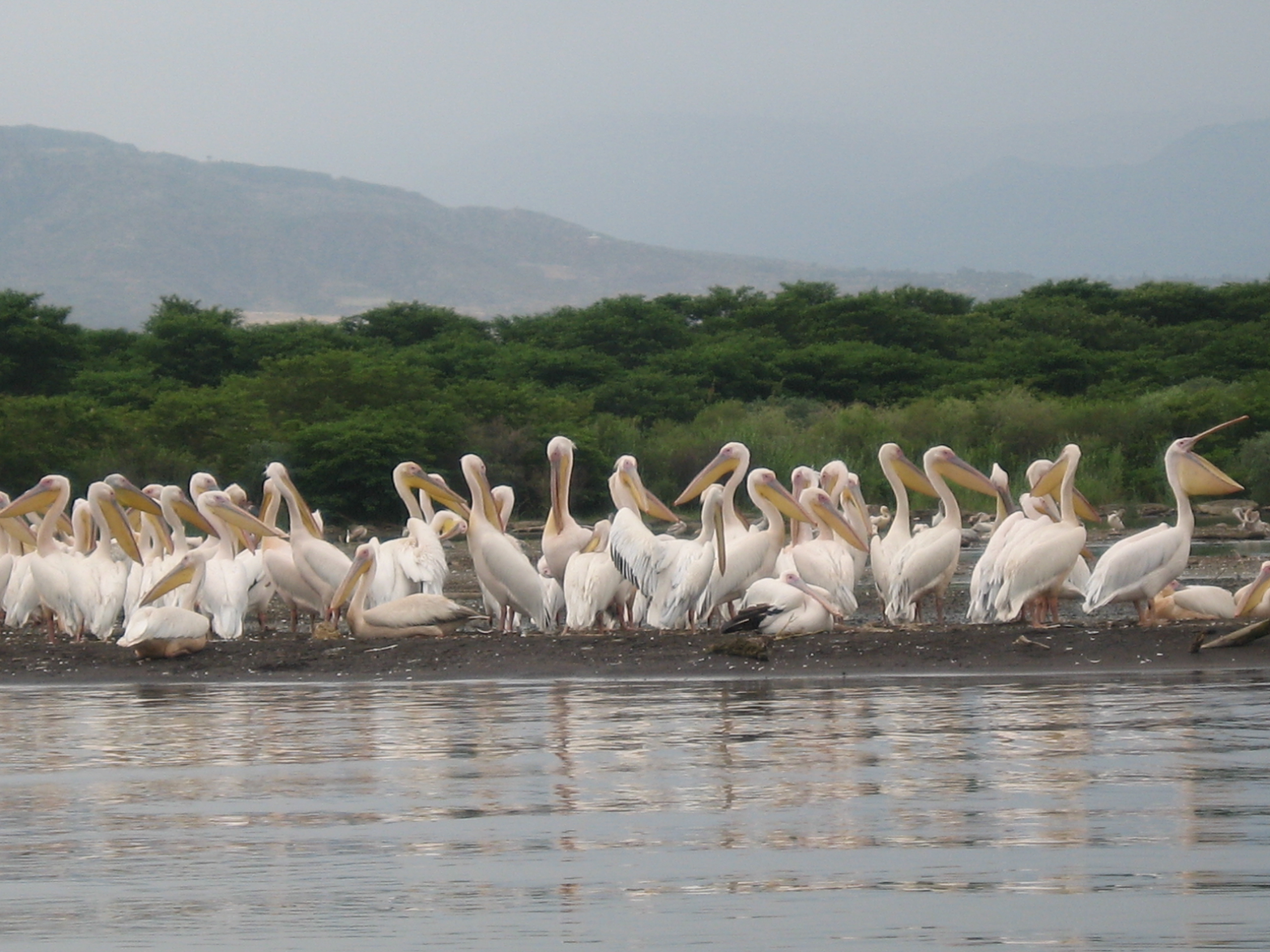
At about 215 kilometress from Addis Ababa, visitors will arrive at Abijata-Shala National Park main gate or “Lakes Park” which was once reputed as one of the bird watchers ground in Africa. It was 887 square.kilometress in area out of which 482 square.kilometress is covered by water of Lake Abijata and Shala. This park used to have about 31 species of mammals such as Spotted Hyena, Golden and Black Backed Jakals, Olive Baboon, Grant’s Gazelle, etc., and 367 species of birds. But currently due to devastated ecology and extreme decrease of Abijata Lake water, one can see only less concentration of flamingoes.
Before, myriad of local and exotic birds that come from Europe and different parts of the world used to congregate here in at Lake Abijata. July to September being the peak season of congregation (and best time to watch birds) in the year. Hundreds of thousands of Flamingoes and Great White Pelicans, Fish Eagles, King Fishers, the tall Marabou Stork, Cormorants and Darters, etc. used to roam here in Lake Abijata and in the side-by lake Shala. There were also vast colonies of sacred Ibis, Queela, Stilt, Snope Black Heron, Avocet, Egyptian Geeze, Eglets, Plovers, etc. It is quite unlikely however, to see most of the birds mentioned above while some species are seen in small number (seasonally), due to the same reason stated earlier.
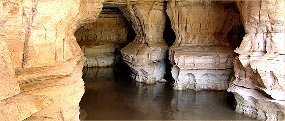
Located at 215 kilometres from Addis Ababa the small enclosure varicocele hcg of Ostrich farm hosts a group of ostriches with some Grant’s Gazelles. At the park’s head quarter one can easily observe (watch) a flock of male and female ostriches and some gazelles. Lake Shala, which is separated to the south from lake Abijata by a strip of land has a delightful view for its deep blue color with excellent reflections of the magnificent western hills. At the north eastern shore of the lake Shala, one can be impressed by a tumbling cascade of hot springs and smoke of vapor that rush out down to the bay. This is typical investment potential for spa resort development and some investors are being attracted by this intact nature.
The other fascinating part of the lake is the Gike Site. It is situated on the lofty land at the south western shore of lake Shala. This is the best site for bird watching and camping. It is accessible by a sturdy car through Aware and Senbete towns found south of Shashamane. Lake Shala is also the ideal lake for water transportation to make touring around the tiny islands and for connecting its western and eastern shore.
South west of lake Shala, there is also a small alkaline crater lake known as lake Chittu. This small lake, more than any other lake, is the best site of bird watching, especially the flamingoes. Chittu is accessible by four wheel drive via Sambaté town.

Tiya steale

Tiya is a megalithic site located at about 80km south of Addis Ababa in Soddo area on the road to Butajira. The monuments are supposed to be remains of medieval Ethiopia culture apparently dated from the 12th to 14th centuries. However, the local people claimed that they were the grave marker of the soldiers of Ahmed Gragn, dating the site to the 16th century.
The Tiya monuments belong to one of stone 160 megalithic sites in the Soddo region. There are more than 45 standing monuments in Tiya. Few of them were removed from the site and can be seen in the main campus of Addis Ababa University 6kilo, erected near the Institute of Ethiopian Studies (IES). Most of Tiya monuments measure a height between a meter and 3 meter though the largest one is about five meters, including its section underground. The Tiya grave-markers are decorated with carvings of various representations. The meanings of the symbolic decorations are still open to speculation for various scholars. The major carved designs of the monuments are the swords, a kind of plants or carvings of leaves below the sword, carved circles, a carving like the letter ‘M’ on its side and the carving like the letter ‘X’ with slightly carved lines. Different scholars give different meanings for the carved

Sof Omar Caves

Sof Omar, a tiny Muslim village in Bale, is the site of an amazing complex of natural caves, cut by the Weyb River as it found its way into the nearby mountains. The settlement, which is a religious site, is named after a local Sheikh.
There one can see an extraordinary number of arched portals, high, eroded ceilings and deep, echoing chambers.

Lake Tana

Lake Tana, the largest lake, in Ethiopia is the source and from where the famed Blue Nile starts its long journey to Khartoum, and on to the Mediterranean. The 37 islands that are scattered about the surface of the lake shelter fascinating churches and monasteries, some of which have histories dating back to the 13th century. However, it should be noted that most of the religious houses are not open to women. The most interesting islands are: Birgida Mariam, Dega Estephanos , Dek, Narga, Tana Cherkos, Mitsele Fasiledes, Kebran and Deber Maryam.

Danakil depression

The Danakil Depression, also called Dallol Depression, is a desert with some areas that are more than 100 meters below sea level. This is special because it is one of the lowest points on 10625052_336086799896785_7362590314756292688_n
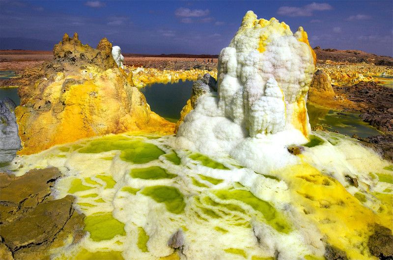
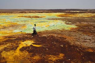
earth not covered by water. There are hot yellow sulfur fields among the sparkling white salt beds. Heat isn’t the only thing people feel in the Dallol Depression. Alarming earth tremors are frequently felt. There are also several active volcanoes. So just how hot is it at the Dallol Depression.

The landscape is dotted with bright yellow sulphur fields, green crystal pools and sparkling salt beds. This is the Danakil Depression, a basin in north-eastern Ethiopia, close to the Red Sea. It is one of the lowest points on earth not covered by water. Danakil is renowned for being the place with the highest average temperature on Earth. It tops 34 °C every day of the year and soars to 55 °C in the summer. Temperatures can reach as high as 63 °C in the sun.

The people who are living in the region are Afar tribes, they are pastoralists and some of them 11889464_468834896621974_1208690523341440302_n
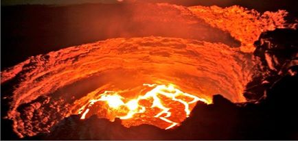
engaged in salt mining as the depression is covered with salt.
The most attraction in the region is Ertale, Active volcano, which is so magnificent attraction due to its different colorful lava flowing from the crust of the earth.

Blue Nile Gorge

Within 30 km of its source at Lake Tana, the Blue Nile River enters a canyon which it does not leave for 400 km. From all over the highlands, huge rivers pour into the Blue Nile Gorge. For a million years the Blue Nile has been carving this huge gash through the Ethiopian Highlands. Nearly 20km wide and over 600km long, this is Africa’s own Grand Canyon. The Grand Canyon in Arizona, U.S.A. and the Blue Nile Gorge have their similarities and differences.

Temple of Yeha

It is an important pre-Axumite archaeological site mainly known by the large square temple and dated to 500B.C. The temple was built using stone blocks without mortar, and is supposed to be the oldest building in Ethiopia. The ruins of the temple consist of a single roofless oblong chamber. The remaining one wall of the temple is still standing to a height of 12 meters. Many stone-carved inscriptions were also discovered in and around Yeha. They are most likely the earliest inscriptions that have ever been discovered in Ethiopia.

Gondar

The historic Gonderine town is very popular mainly because of the marvelous castles in the royal enclosure. There are six graceful castles in the palace compound built by the successive Gonderine Kings of the 17th and 18th centuries. The tradition was first set by Emperor Fassiledes and then followed by his successors. The castle were built from local stone, hard dark brown basalt and red volcanic lava held together with lime mortar within the fortified royal compound at aboubt 70,000 square meters. The 12 symbolic entrances (gates) of the palace compound have various names and represent the 12 apostles of Jesus Christ.

Rock-hewn churches of Tigray

Tigray is recognized as the cradle of the ancient Ethiopian civilization. The Yeha temple and the Axumite monolithic steleas testify to this. Numerous archeological sites underline the long history of the region, where the first Christian state in the world was established in the fourth century. Thus the old churches of Tigray are the testimony to this history.
The rock-hewn churches are a landmark achievement of church building in Ethiopia. Lalibela being the most famous, but so many others to be found in Tigray. Abreha Atsbeha is one of the outstanding rock hewn churches, found beautifully situated between Wukro and Hawzien. The spacious high barrel-shaped ceiling contains various artful ancient works of art.

Ankober and Emperor Menelik II Palace

Ankober was the ancient capital of the Kingdom of Shoa, with Merid Azmatch Amha Iyesus (1745-1775), a ruler descended from the Solomonic dynasty, credited as being the founder. His descendents ruled from Ankober for around a hundred years and a number of Shoan rulers are buried in churches in the area.
During the reign of Emperor Menelik II, Britain, France and Italy established diplomatic missions in Ankober, and the sites of their missions can still be distinguished. Menelik married Itegue Taytu at the Ankober Medhane Alem Church, where the golden wedding cloak is still kept. In 1886 Menelik decided to move the capital to its current location, Addis Ababa.
There are many famous Ethiopian Orthodox monasteries and churches in the area surrounding Ankober, including Mantiq a nearby monastery with Judeo-Christian traditions. The nineteenth century Catholic missionary, Aba Massayas, started missionary activities in neighboring Fiqre Gimb, making the area one of the most important historical centers of Catholicism in Ethiopia.
Ankober Palace hill overlooks the spectacular scenery of the Rift Valley, stretching from the Red Sea to the plains of Afar Region.